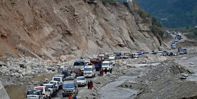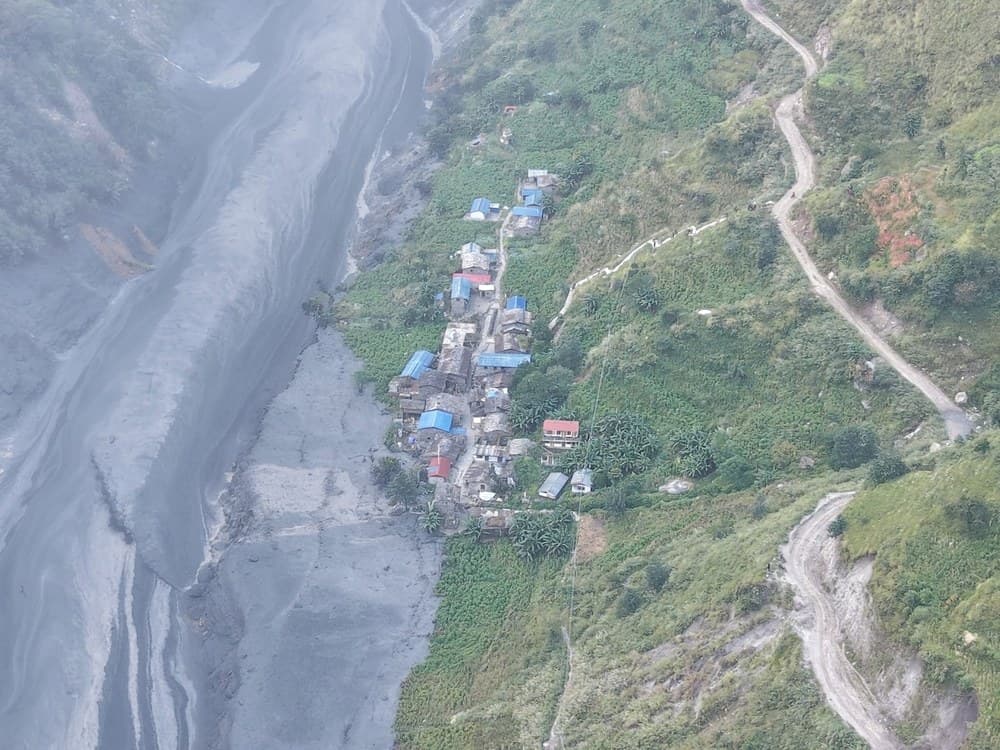
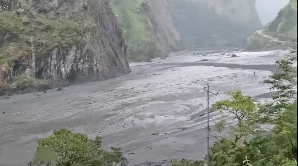
Preliminary field reports from local administration, Nepal Police, and road officials document substantial damage to settlements, pedestrian bridges, and infrastructure along the Budhi Gandaki corridor.
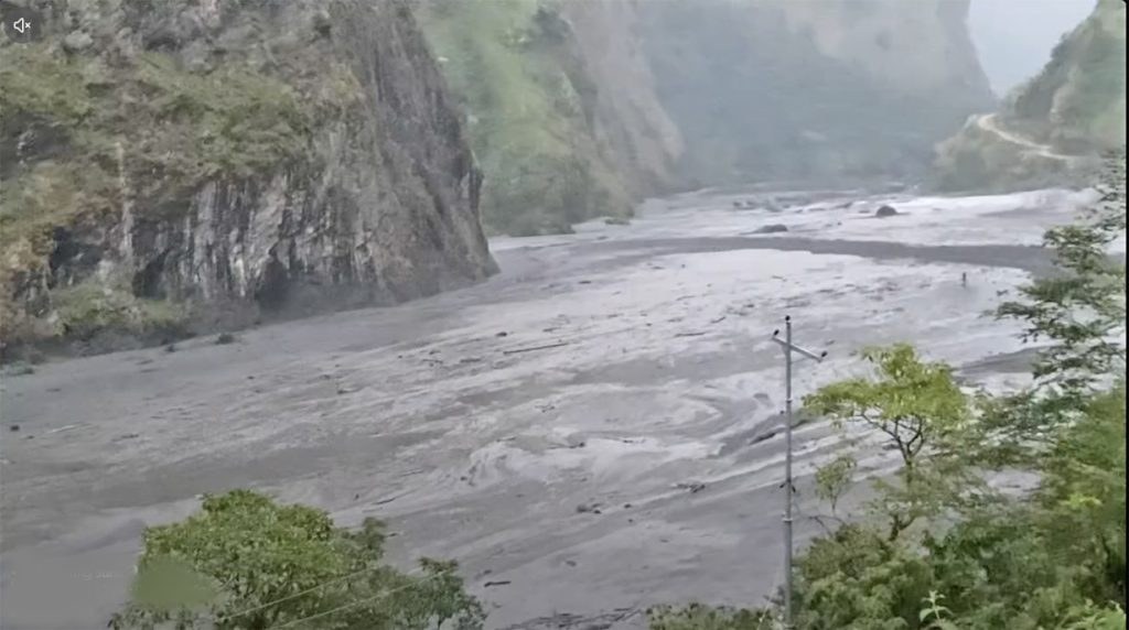
A sudden, sediment-choked flash flood swept down the Budhi Gandaki river in northern Gorkha on Sunday morning, destroying residential homes, washing away critical trail bridges, and wrecking the base camp of a major hydropower project under construction.
1. What Happened
Early Sunday morning, water levels along the Budhi Gandaki river in Chumnubri Rural Municipality fluctuated abruptly before surging with a thick mixture of black silt, timber, and boulders.
The flood surged downstream through Chumnubri, Dharche, and Aarughat rural municipalities. The Department of Hydrology and Meteorology (DHM) hydrometric station at Aarughat registered a sharp spike to 5.1 metres, exceeding the 5.0-metre danger threshold, before fluctuating as the pulse propagated downstream.
2. Reported Damage by Location
Initial damage reports gathered by local local governance units and reported by The Kathmandu Post distinguish between structures destroyed, inundated, or facing active erosion:
| Location | Impact Category | Reported Extent | Reporting Source |
|---|---|---|---|
| Chumnubri Settlements (Jagat Bagar, Salleri, Ghattikhola) | Swept away | Estimated 35–40 residential houses destroyed | CAO Narayan Prasad Sapkota / Kathmandu Post |
| Chumnubri-3 (Sirdibas) | Structural destruction & water ingress | 1 house washed away; 1 house entered by floodwaters | Gorkha District Police Office |
| Dharche-5 (Machhakhola Lower) | Inundation | 5–7 houses and 5–7 temporary structures submerged | District Police field personnel |
| Dharche-3 (Salleri) | Bank erosion risk | 20 to 22 residences threatened by bank scour | Provincial health and disaster monitoring |
| Aarughat-9 (Aarughat Bazar) | Precautionary clearance | Riverside market shops evacuated to higher terrain | Ilaka Police Office Aarughat |
3. Named Bridge and Access Impacts
The flood tore away or damaged key river crossings essential for both pedestrian transit and motor links:
- Sardibhir Cantilever Bridge (Lokpa, Chumnubri): As reported by Onlinekhabar, the 90-metre cantilever walkway drilled into the sheer cliff face at Sardibhir in Lokpa was washed away. This crossing serves as the sole walking link connecting Ward 6 (Chumchet) and Ward 7 (Chhekampar) to the lower Manaslu trail.
- Nyakchet–Sirdibas Suspension Bridge (Chumnubri-3): A critical pedestrian suspension bridge was swept away, cutting direct walking connections to Philim and upper trails.
- Machhakhola–Kerauja Suspension Bridge (Dharche-5): The suspension bridge linking Machhakhola with Kerauja was destroyed by flood debris.
- Soti Motorable Steel Bridge (Aarughat): The motorable steel bridge across Soti Khola was washed downstream.
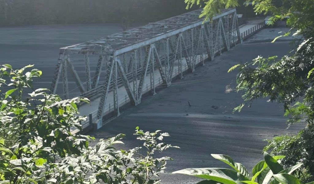
- Aarughat–Dhading Bridge (Nayapul, Aarughat-9): Official assessments clarify that the bridge was not entirely destroyed. The crossing consists of a 60-metre steel truss and a 25-metre concrete structure. Floodwaters tore away the 22-metre reinforced concrete approach span on the Gorkha bank, while the 60-metre central steel truss remains intact. The Department of Roads is examining temporary Bailey bridge solutions to restore connectivity.
4. Verified Hydropower Project-Site Information
Infrastructure damage occurred at the 341 MW Budhi Gandaki Hydroelectric Project (PRoR), under construction by Times Energy Pvt. Ltd. (a subsidiary of Sahas Urja Ltd.).
At the project’s site in Salleri (Chumnubri Ward 3), floodwaters surged into the main construction camp, washing away and damaging camp buildings and construction machinery. According to project representatives and local officials, all on-site personnel evacuated safely to higher ground following early warnings.
5. Brief Rescue Status
The Nepal Army mobilized air and ground personnel, rescuing a cumulative total of 36 people from stranded riverside pockets in Jagat, Nyakphedi, Yaru, and Paiyu. Search operations continue for individuals reported out of contact in remote highland sheds. For detailed operational figures, consult HamroBuzz's Dedicated Rescue & Assistance Report.
6. Outstanding Uncertainties & Sources
Complete damage assessments await the restoration of ground foot trails and telecommunication links in upper Chumnubri.
Sources & Verification References:
- Official Agencies: Department of Roads; Department of Hydrology and Meteorology (dhm.gov.np); District Administration Office Gorkha; District Police Office Gorkha.
- Local Administration: Chumnubri Rural Municipality (Chief Administrative Officer Narayan Prasad Sapkota; Vice-Chair Laxmi Gurung); Dharche Rural Municipality.
- News Reports: Hariram Uprety, The Kathmandu Post (October 11, 2026); Onlinekhabar report 2036961 (Sardibhir cantilever bridge).
- Photographic Credits: Photojournalist Gurung Suna via Onlinekhabar; Department of Roads / Nepal Police.